
To use the system, valid user registration and subsequent login are required. During login, the system verifies the provided data; if correct, the user is granted access to the system's services. In case of a forgotten password, there is an option to request a temporary one. The registered data can later be modified anytime through the system’s About feature.
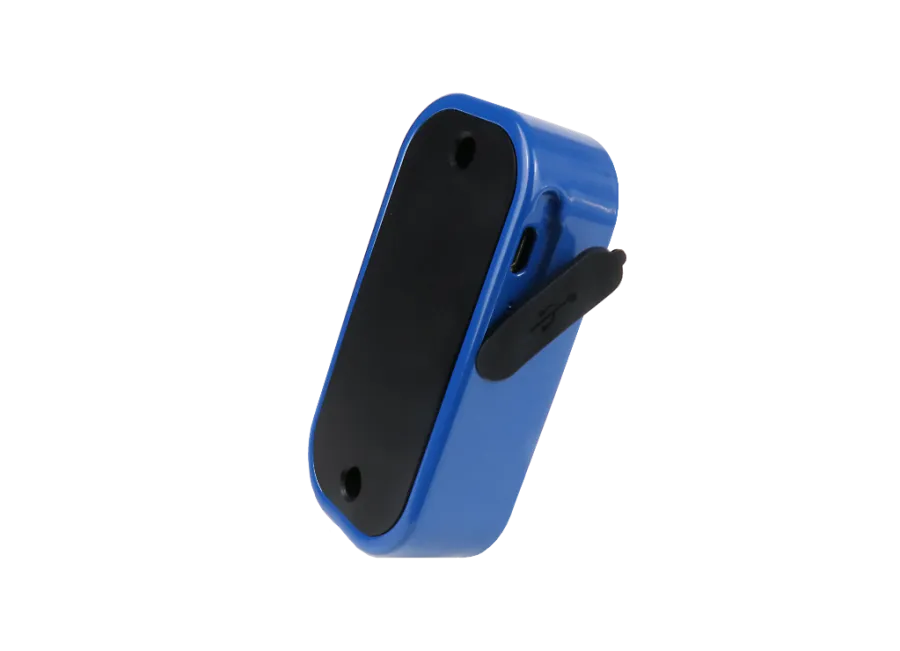
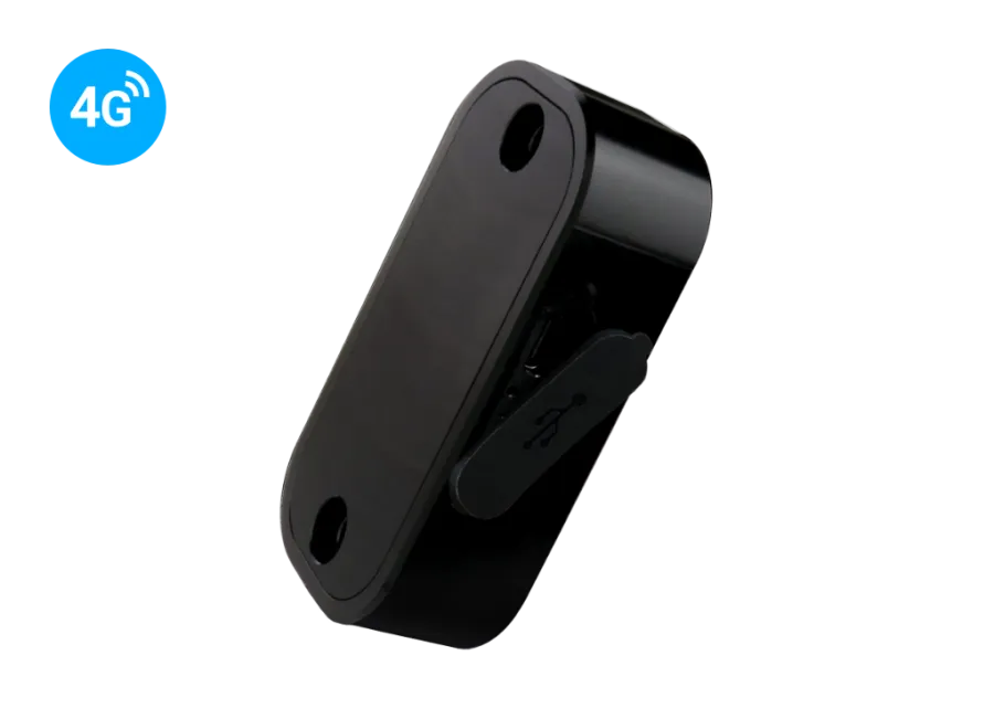
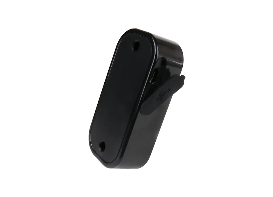
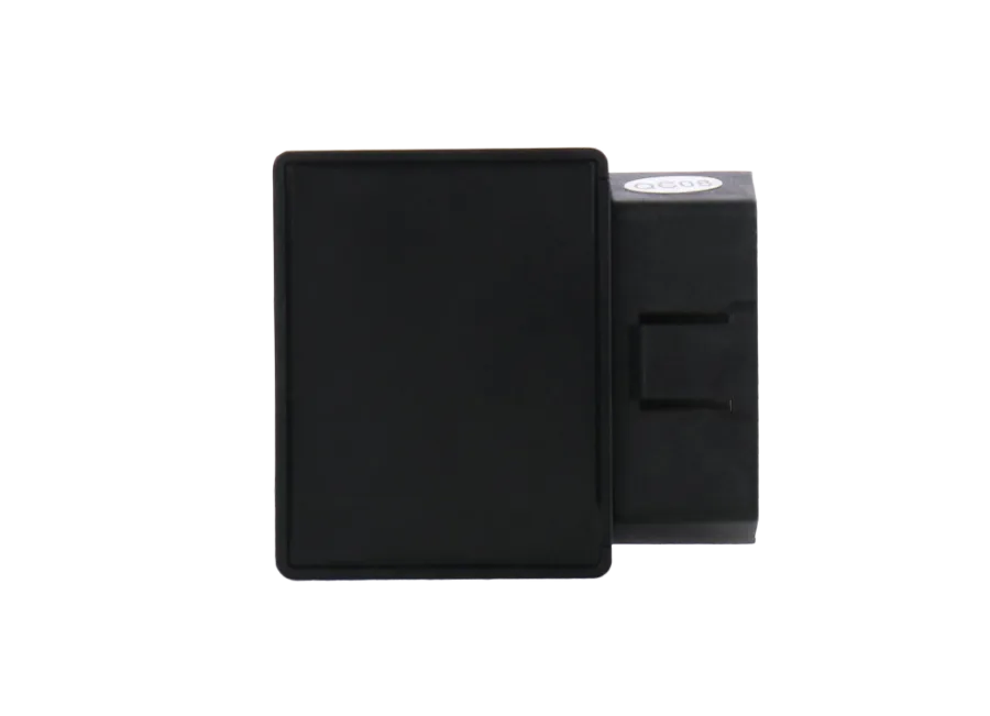
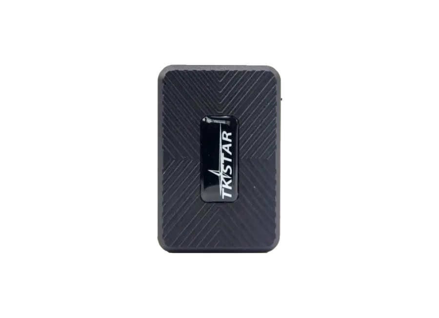
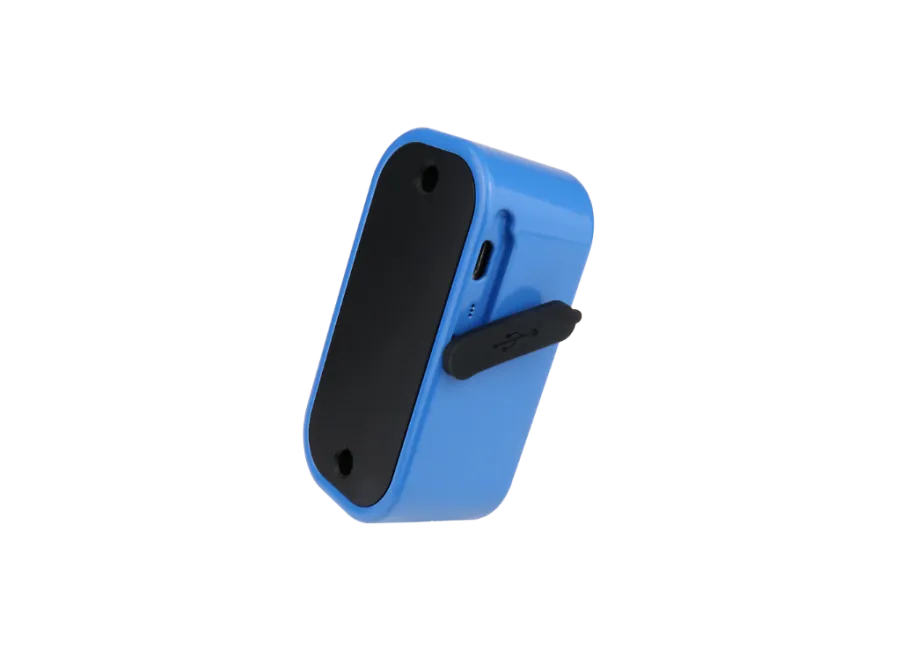
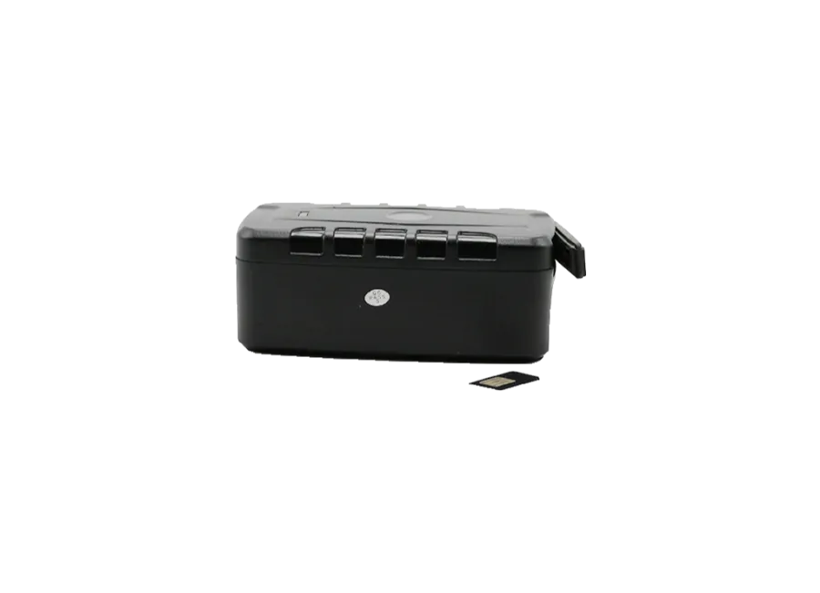
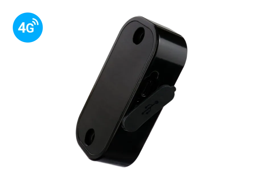
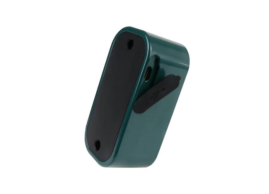
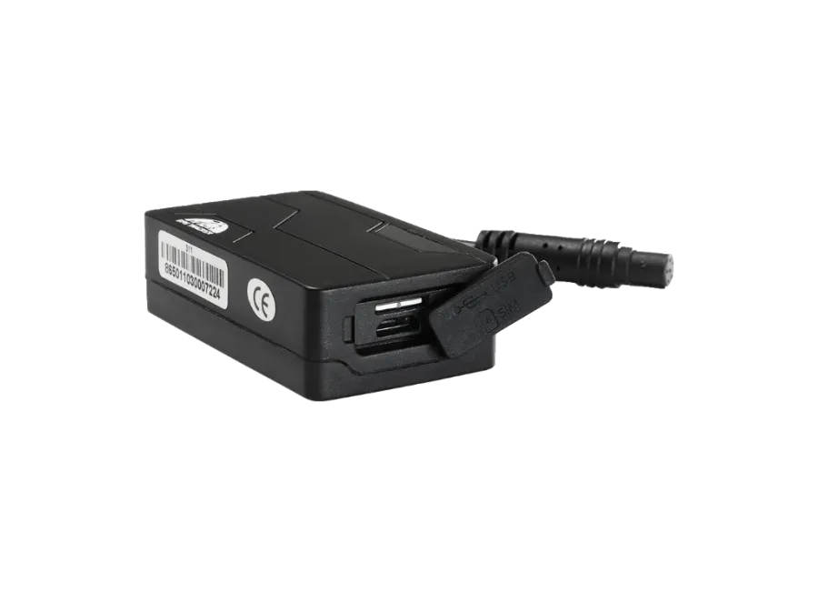
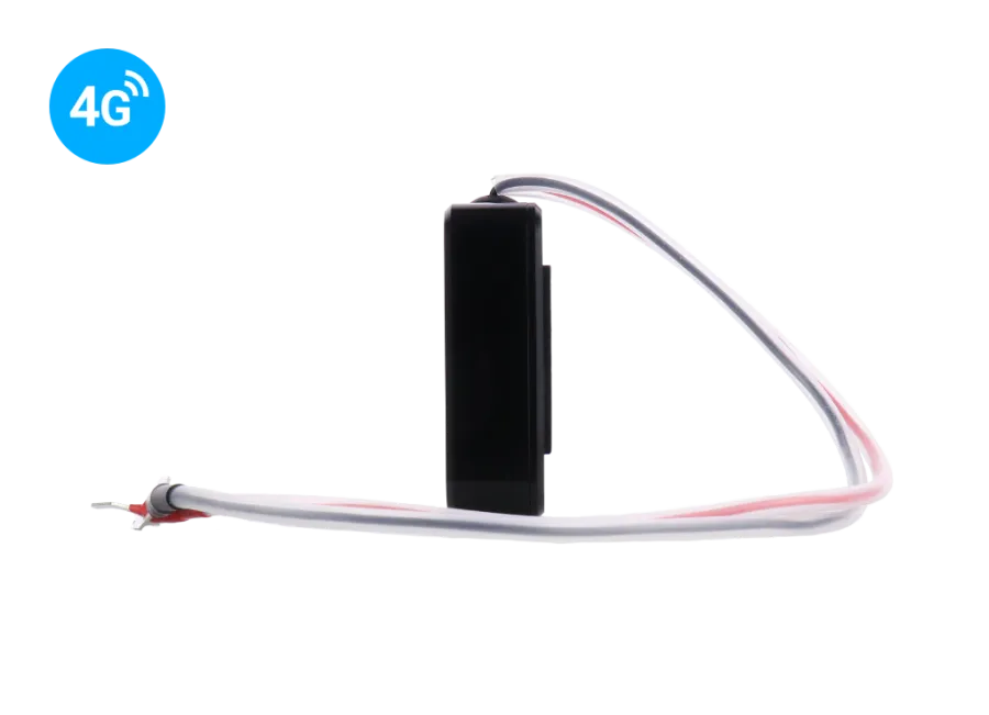
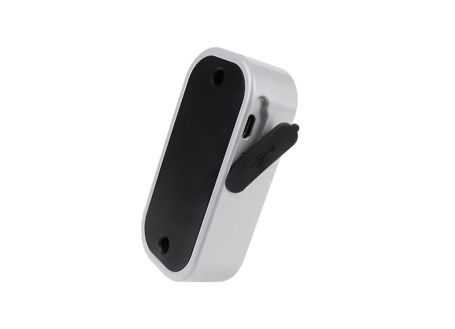
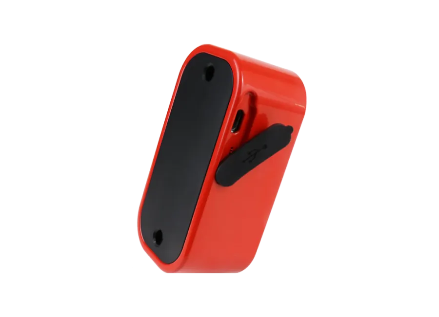
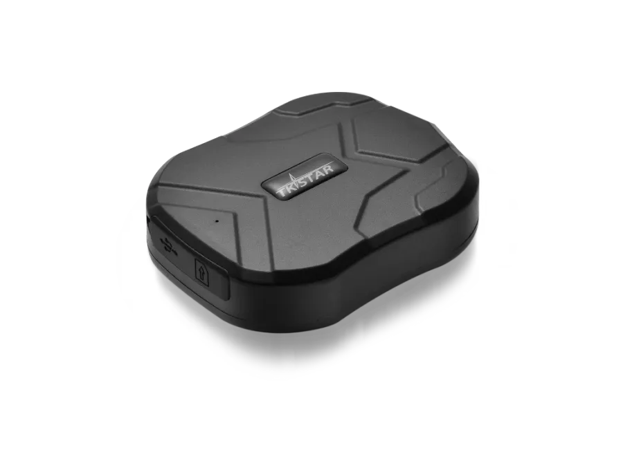
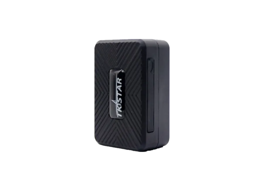
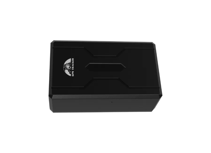
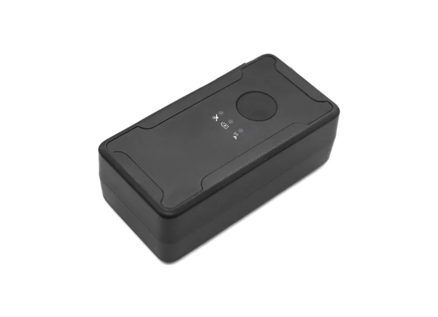
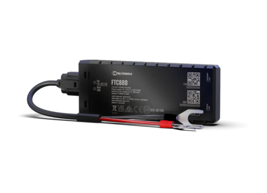
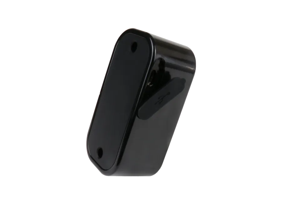
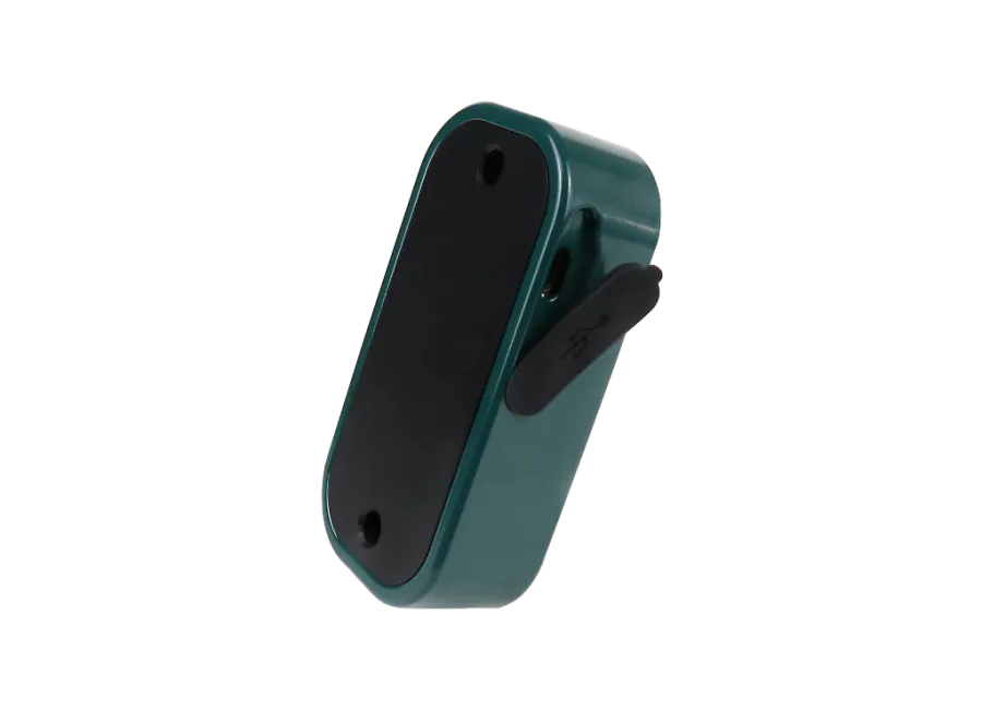
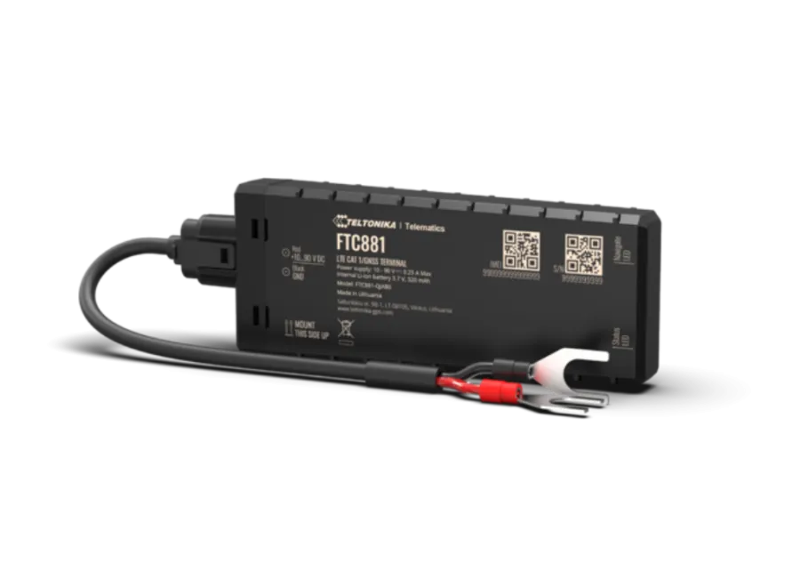
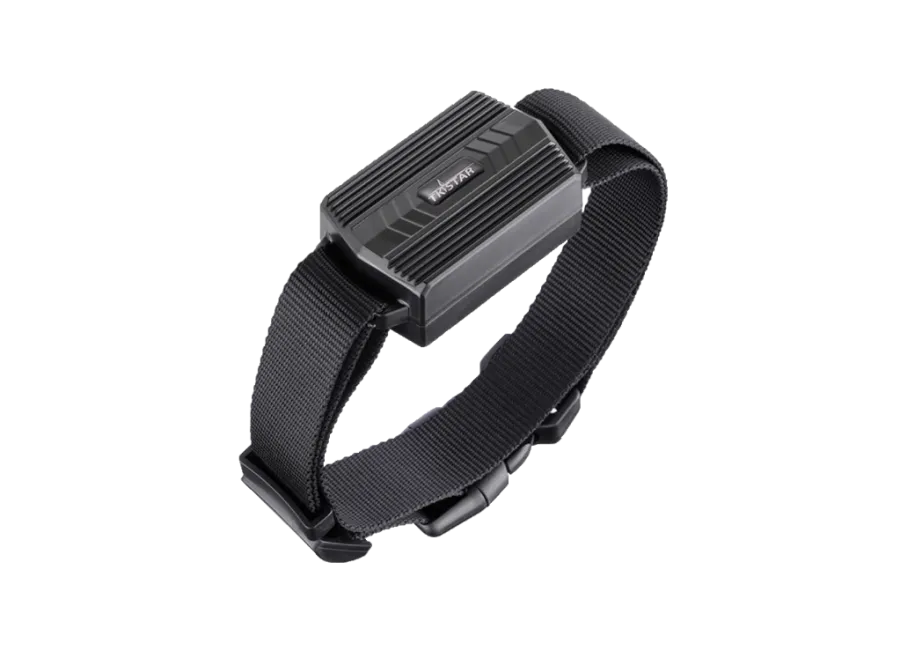
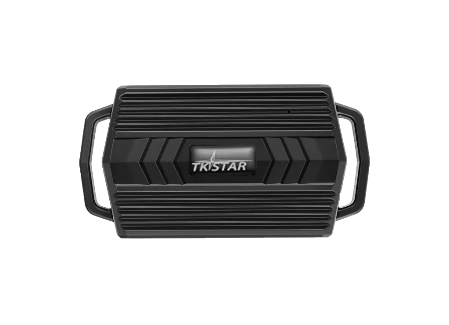
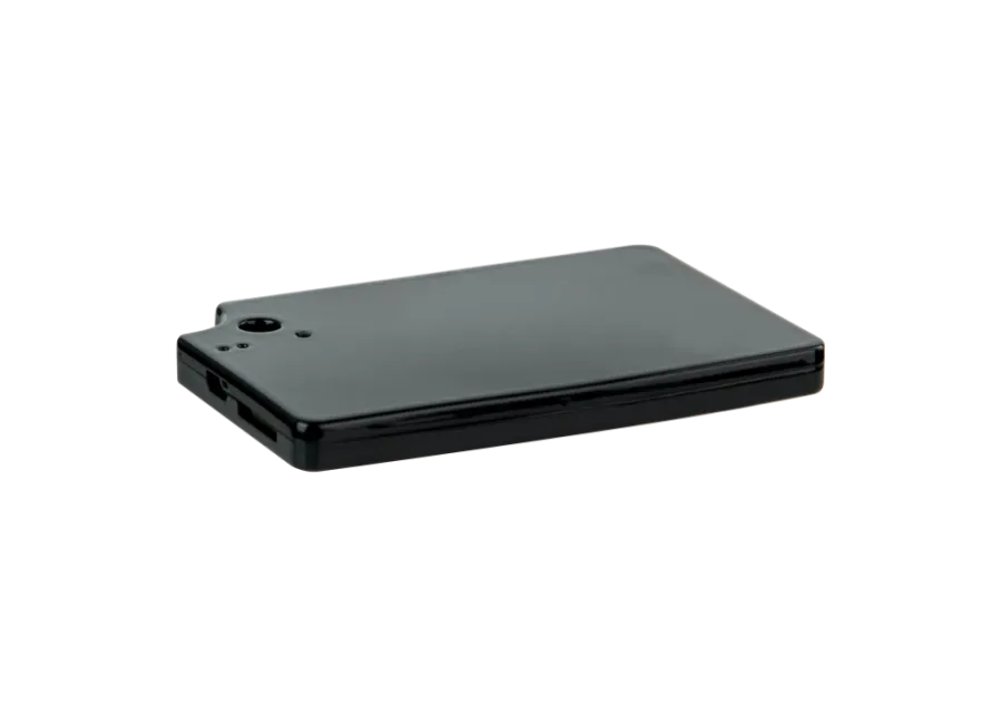
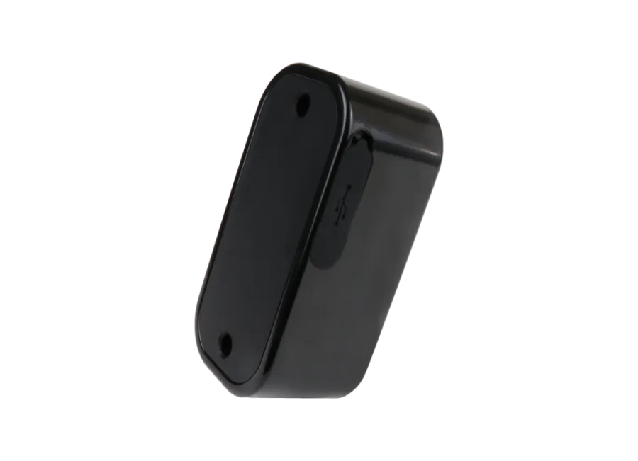
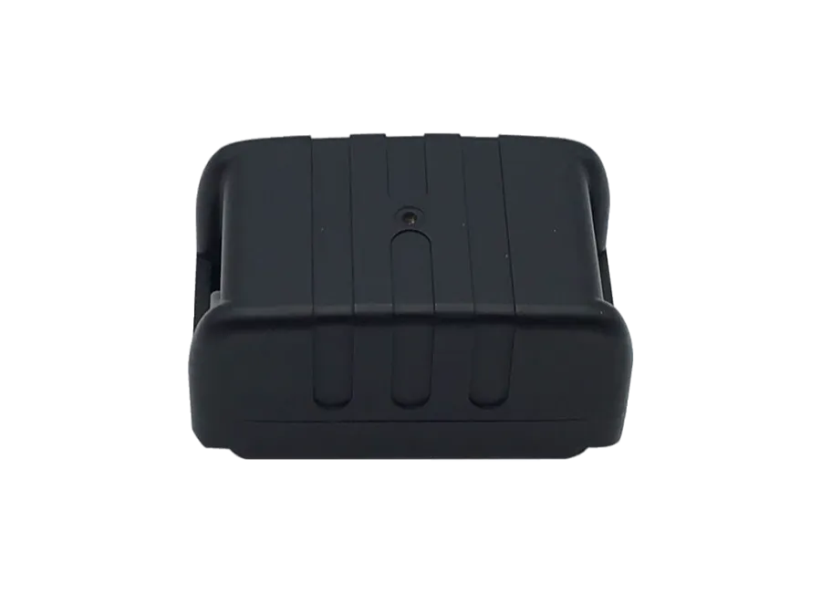
FLEXCOM FB242REBK9005FR6366 4g lte roller gps tracker
Brand: FLEXCOM
Product code: FB242REBK9005FR6366
EAN: 5999568891241
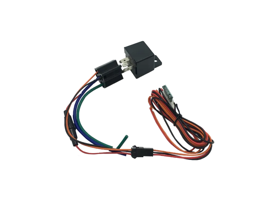
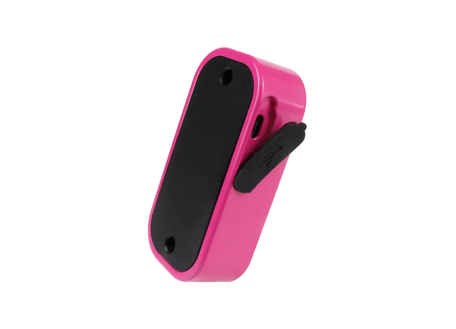
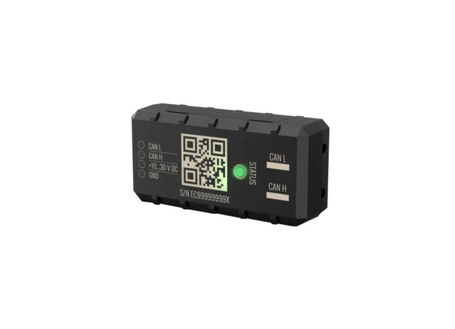
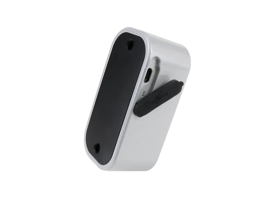
FLEXCOM FB242REBK9005FR6366 4G LTE scooter GPS tracker This GPS tracker is designed for tracking scooters. Basic services: location determination, alerts. Placement on the handlebar using the included mounting clamp. Communication via mobile networks with a SIM card using tracking software. More information
0
$
(0
$ + 1% VAT)
RRP price: 204,16 $
-
In stock0 pcs
-
Personal receiptFree
-
Expected delivery-
-
Guarantee24 months
-
Home delivery-
-
Location of goodsHungary
Device description
FLEXCOM FB242REBK9005FR6366 4g lte roller gps tracker
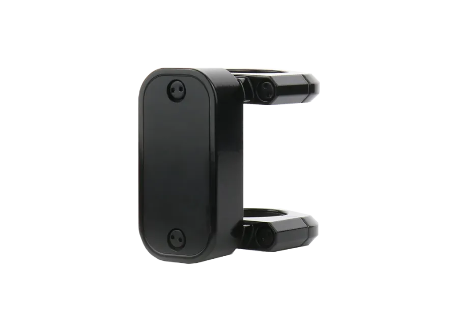
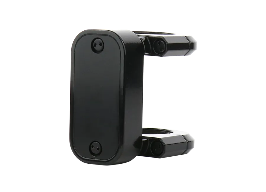
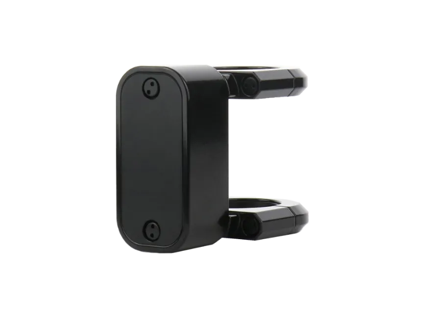
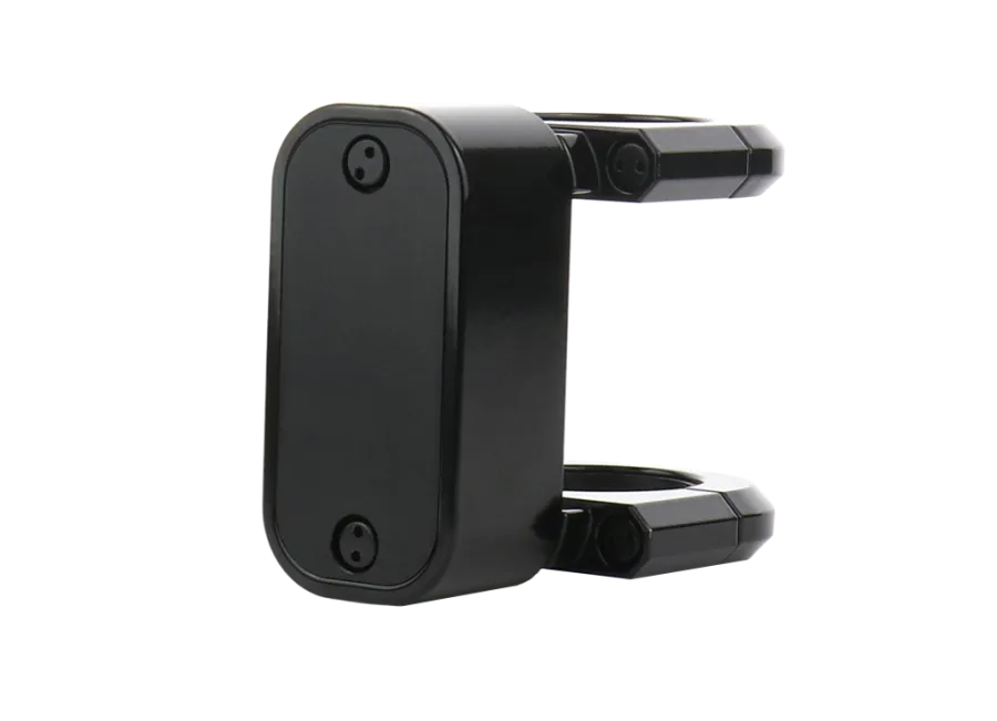
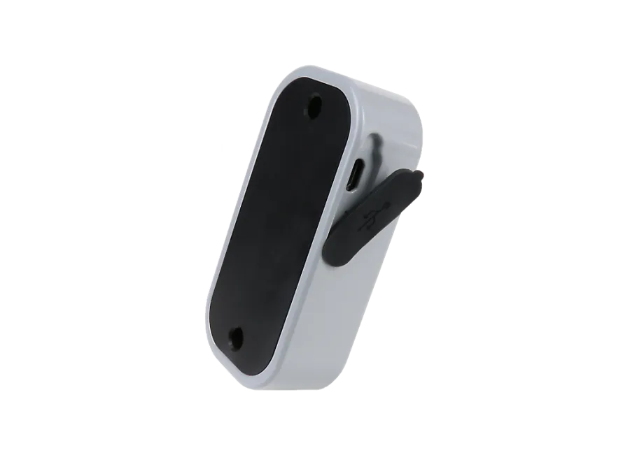
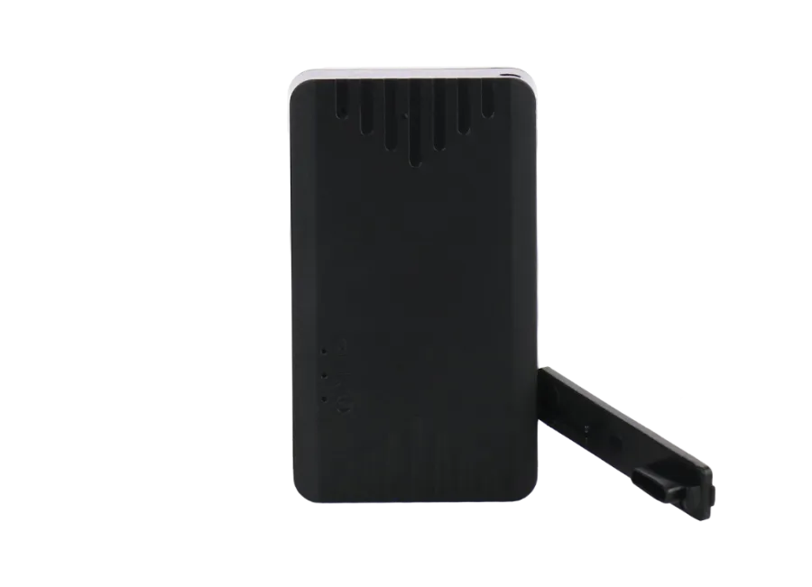
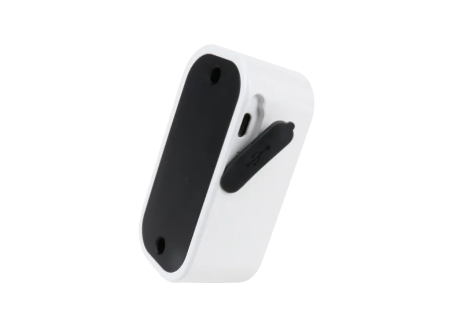
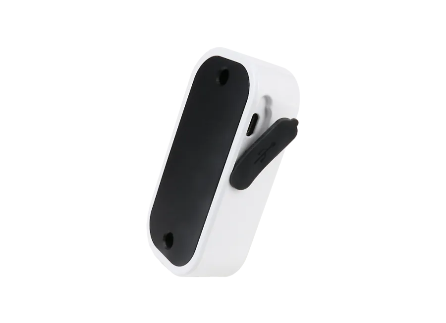
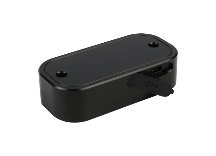
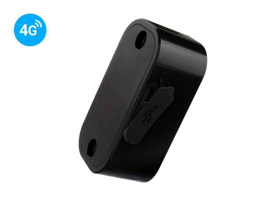
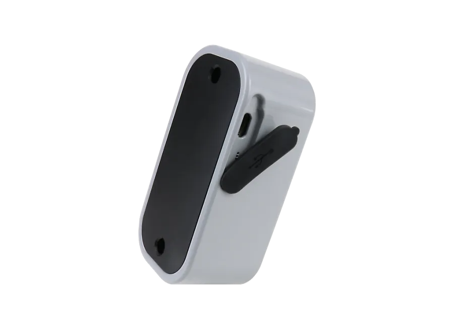
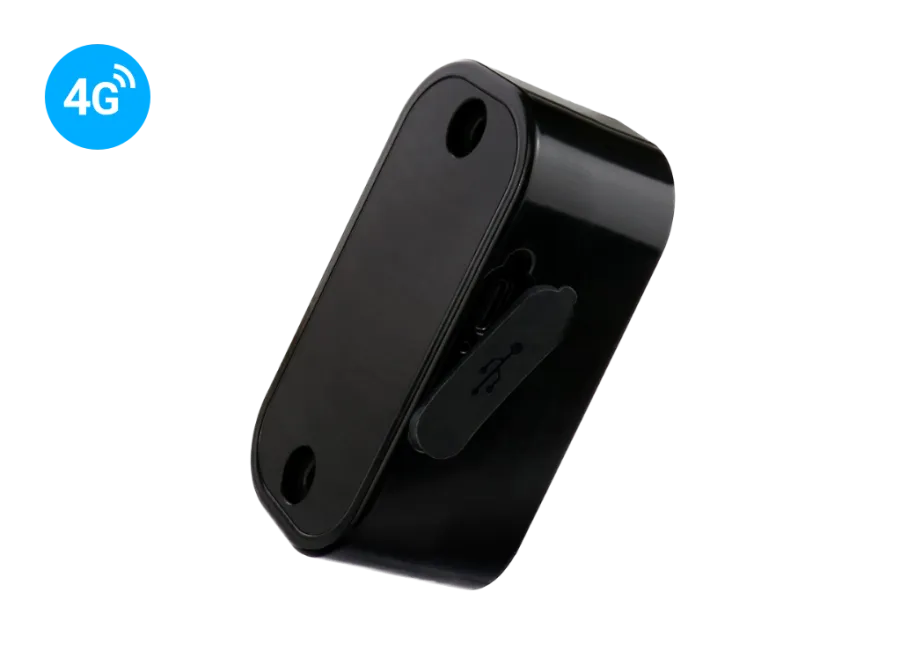
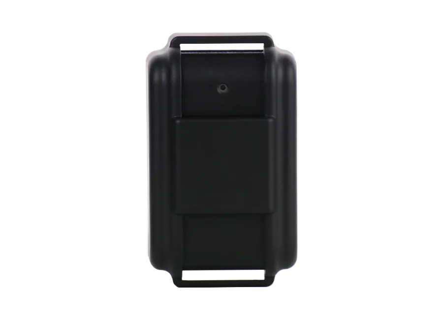
This device equipped with a mounting clamp was primarily developed for scooter owners. Integrated with our tracking software, it provides comprehensive location determination, map-based tracking, sports, and security functions.
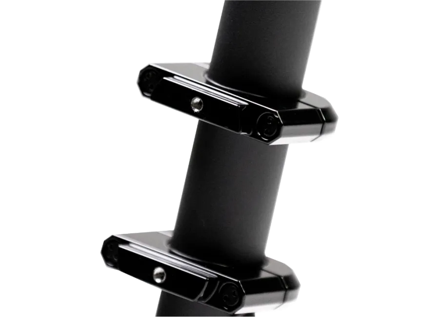
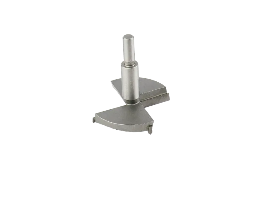
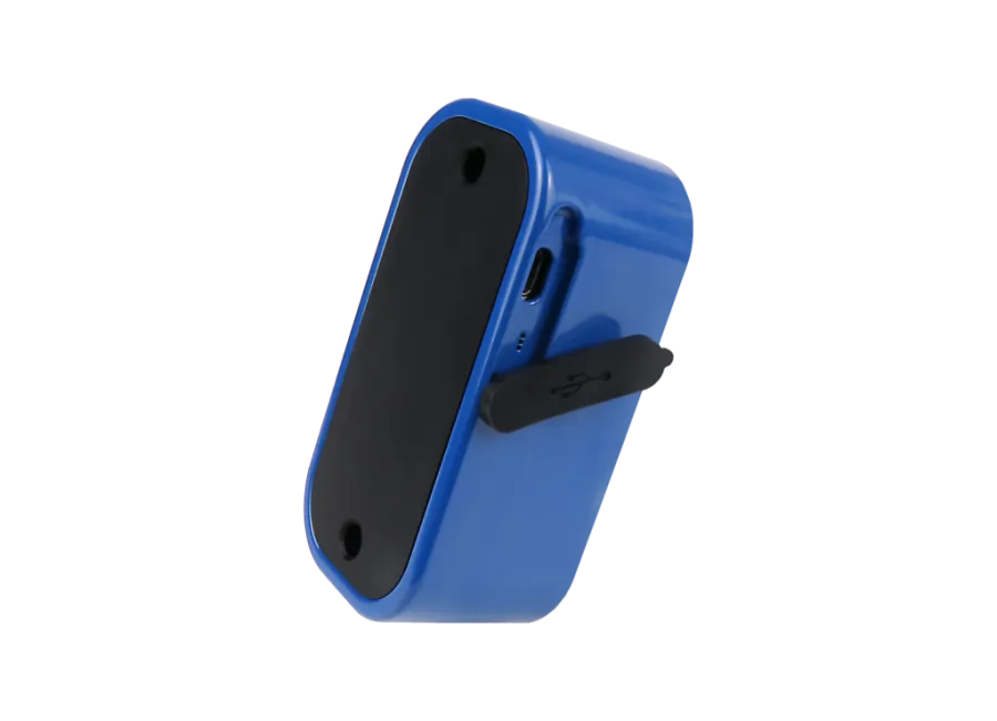
The clamp is made of durable, rust-resistant, powder-coated aluminum with an M5 screw hole, suitable for Segway and Xiaomi electric scooters, and other similar-sized scooters.
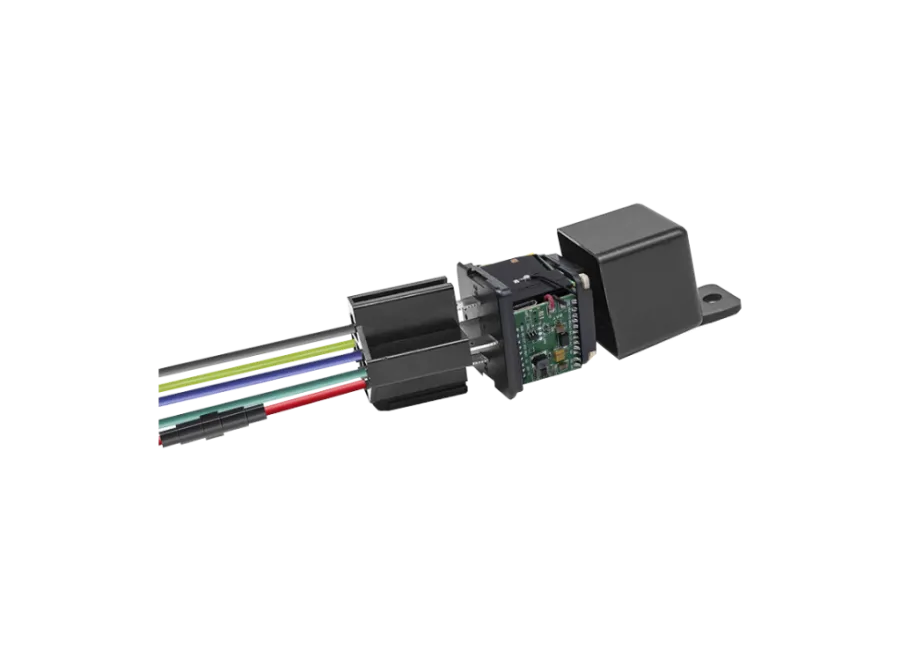
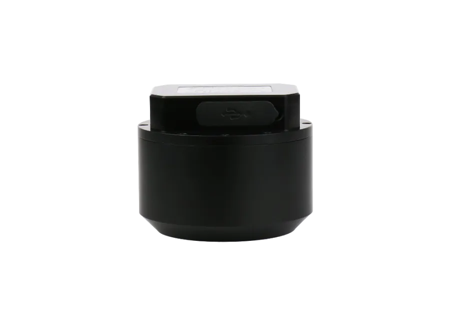
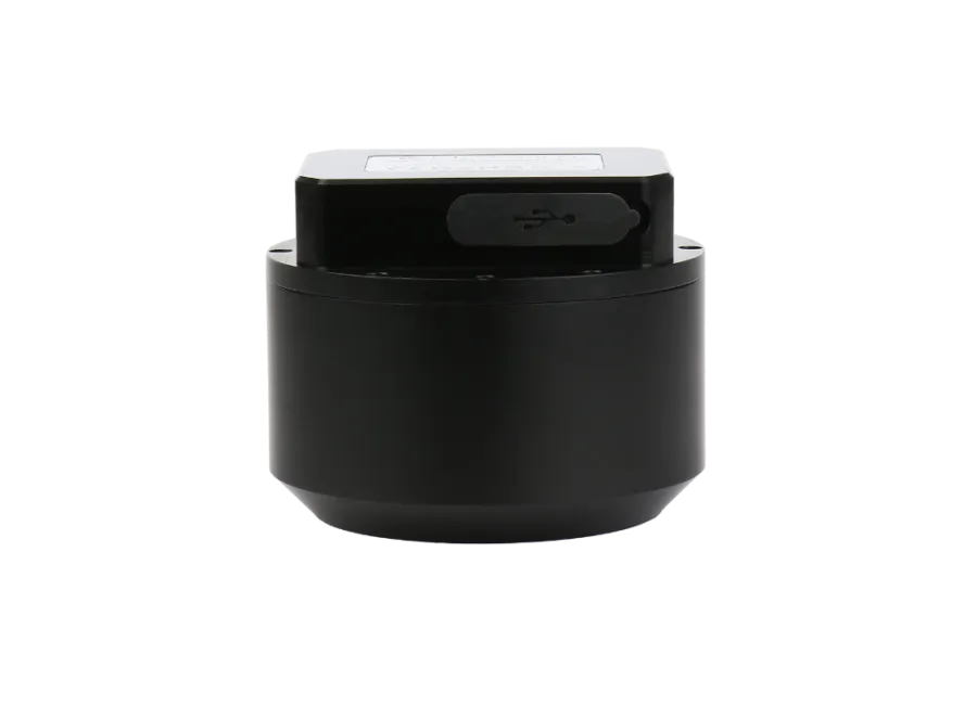
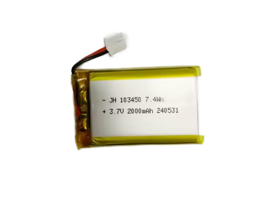
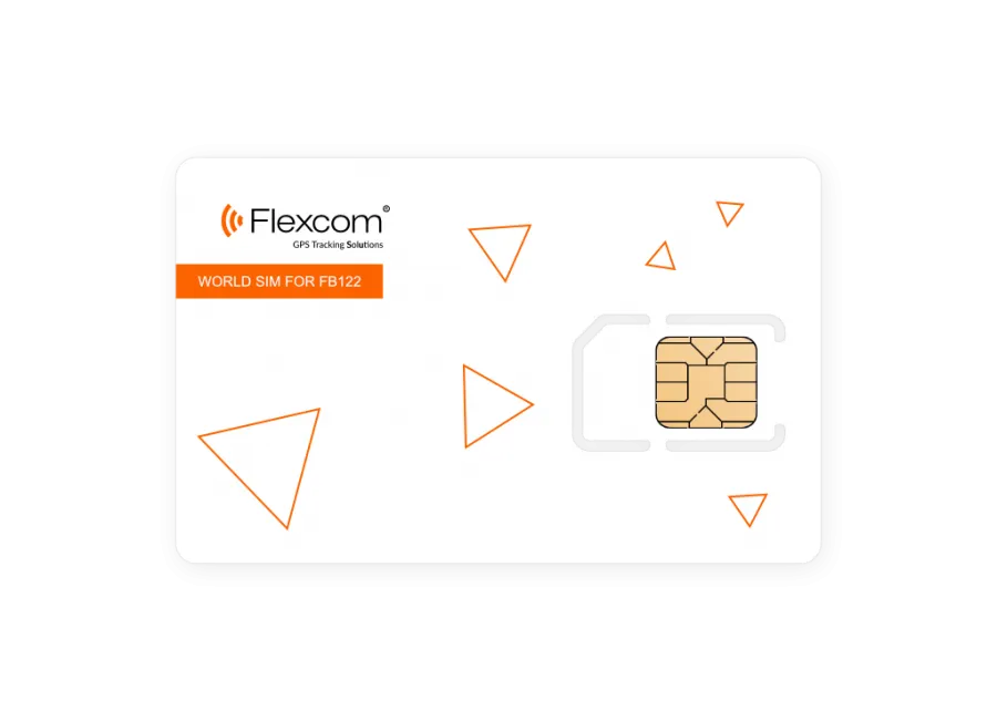
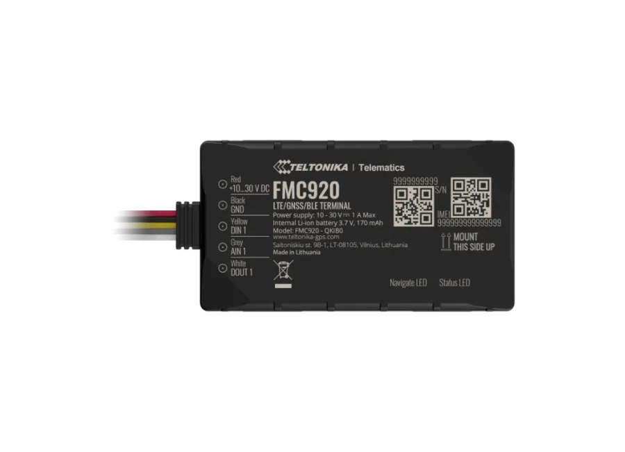
The device has a built-in SIM card usable anywhere in the world*, a battery providing a 15-day standby time, and a robust, waterproof (IP65), rust-resistant metal casing. Measurement accuracy is 5 meters. With the built-in motion sensor, we can receive an immediate alert if the device or the scooter is moved by unauthorized persons. It operates continuously and cannot be turned off. When the battery runs out, it automatically turns on when the charger is connected.
Communication occurs through the built-in SIM card and the internet connection provided by mobile operators (4G and 2G). The device's current location, previous routes, statistics, etc., are provided by our developed and operated computer or mobile application.
* The built-in SIM card can only be used in the following countries: Albania, Algeria, Anguilla, Antigua and Barbuda, Argentina, Armenia, Austria, Azerbaijan, Barbados, Belarus, Belgium, Bosnia and Herzegovina, British Virgin Islands, Bulgaria, Cambodia, Cayman, Chile, China, Colombia, Croatia, Cyprus, Czech Republic, Denmark, Dominica, Egypt, El Salvador, Equatorial Guinea, Estonia, Faroe Islands, Finland, France, Germany, Gibraltar, Great Britain, Greece, Greenland, Grenada, Guernsey, Guyana, Hong Kong, Hungary, Iceland, India, Indonesia, Ireland, Isle of Man, Israel, Italy, Jersey, Jordan, Kazakhstan, Kosovo, Kyrgyzstan, Latvia, Liechtenstein, Lithuania, Luxembourg, Malaysia, Malta, Mexico, Moldova, Monaco, Mongolia, Montenegro, Montserrat, Netherlands, New Zealand, North Macedonia, Norway, Oman, Palestine, Paraguay, Peru, Philippines, Poland, Portugal, Romania, Russia, Saint Kitts and Nevis, Saint Lucia, Saint Vincent and the Grenadines, Serbia, Slovakia, Slovenia, South Africa, Spain, Sri Lanka, Sweden, Switzerland, Thailand, Tunisia, Turkey, Turks and Caicos Islands, Ukraine, United Arab Emirates, USA, Vietnam, Hong Kong
Services, features
- Cooperation with multiple satellite systems (GPS, GLONASS, GALILEO, BEIDOU)
- Communication between the device and its owner via GSM 2G and 4G networks using a micro SIM card
- Operational settings, position query through software
- Customizable position measurement interval (min. 10 seconds)
- Push, email, and SMS alerts setup
- Power on when connected to power
- Moisture and splash-proof, robust casing (IP65)
- Built-in accelerometer, gyroscope
- Internal battery with 15 days standby time
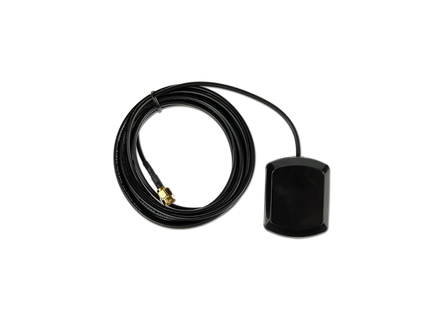
- Internal high-sensitivity GNSS antenna
- LED indicators for operation monitoring
- Automatic switching between sleep and wake modes (if the function is activated)
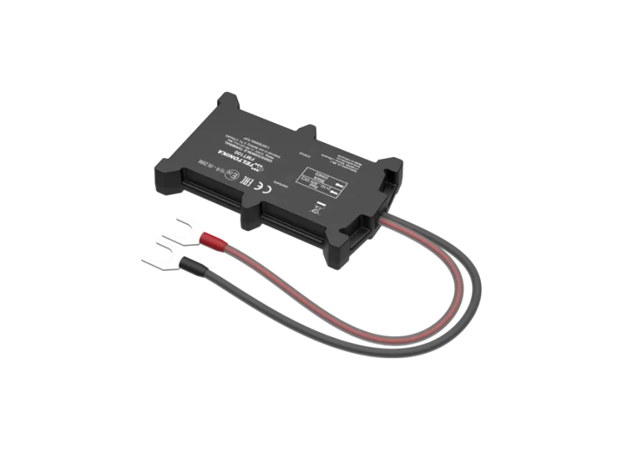
- Mounting clamp dimensions:
- Outer size: 66 mm X 63.3 mm
- Inner size: 40.6 mm X 33.15 mm
Alerts
- Movement
- POI digital fence exit, arrival
- Low battery level
Package contents
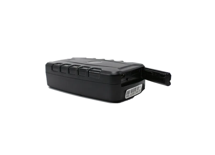
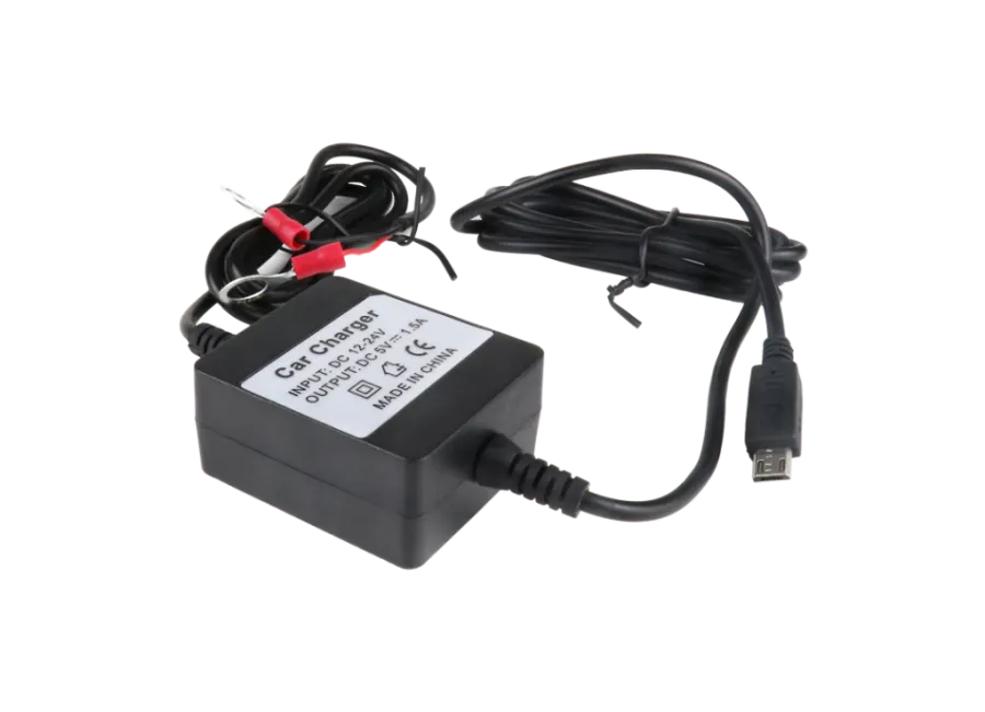
- FLEXCOM FB242REBK9005FR6366 4G LTE scooter GPS tracker
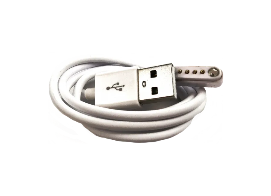
- USB charging cable
- Mounting clamp FR6366
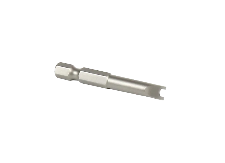
- 2 safety steel screws and 1 safety bit head
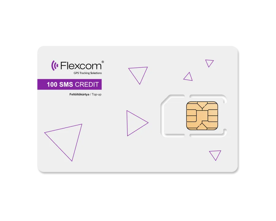
- SIM card fee and software license for desktop and mobile for one year
Terms of use
For normal operation, an active connection with satellite positioning systems and mobile networks is required. These ensure data collection and transmission, as well as communication with the owner's phone or the central data collection and processing system when using tracking software. The device communicates through mobile networks using the installed SIM card.
Operational regions
The device is compatible with GSM networks operating in the following regions:
- 4G: Europe, Asia, Africa
- 2G: Worldwide
Purchase options
- This device is not sold separately without a SIM card and software license.
- The device is provided ready to operate, and we ensure its continuous operation – you will have no tasks related to this.
If you wish to use our software's SMS alert service, purchase an SMS credit card in our webshop.
Other information
- The device is protected by a security label; disassembly is prohibited as it may damage the device and void the warranty.
- If you wish to transfer the device to someone else, please contact our customer service for user registration transfer.
- We provide servicing for the device even after the warranty period (GPS antenna, GSM antenna, motherboard, and battery replacement).
We strive to ensure the continuous update and accuracy of the data and images displayed on the website. However, please note that the manufacturer reserves the right to modify product specifications or packaging without prior notice. As a result, the actual appearance of the products may differ slightly from the images shown. We reserve the right to accept manufacturer changes regarding potential discrepancies.
View full description CloseParameters
| Design | |
|---|---|
| Width | 41 milimeter |
| Height | 22.3 milimeter |
| Length | 85 milimeter |
| Weight | 130 gram |
| Material | metal |
| Ingress Protection Rating | 65 |
| Color | black |
| Operation | |
| Operating temperature without battery minimum | -20 Celsius |
| Operating temperature without battery maximum | 55 Celsius |
| Battery charge temperature minimum | 0 Celsius |
| Battery charge temperature maximum | 45 Celsius |
| Battery discharge temperature minimum | 0 Celsius |
| Battery discharge temperature maximum | 60 Celsius |
| Battery storage temperature minimum | 0 Celsius |
| Battery storage temperature maximum | 45 Celsius |
| Operating humidity minimum | 5 % |
| Operating humidity maximum | 95 % |
| Cold start | 28 secundum |
| Warm start | 6 secundum |
| Hot Start | 3 secundum |
| Battery standby time | 285 hour |
| Battery operating time | 20 hour |
| GPS Sleep | yes |
| Minimum data upload frequency | 10 secundum |
| Data upload frequency is maximum | 43200 secundum |
| GPS | Yes |
| Manual geofencing | yes |
| GPS | yes |
| Energy | |
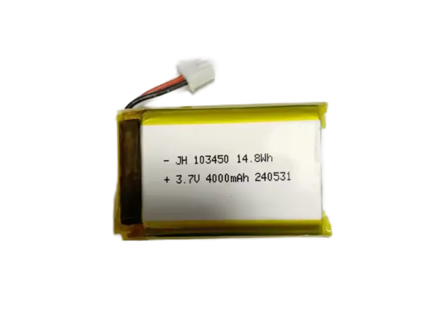
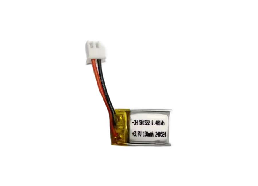
| Internal battery | yes |
| Backup battery capacity | 2000 mAh |
| Backup battery voltage | 3.7 V |
| External power source | yes |
| Input (DC) voltage minimum | 5 V |
| Input (DC) voltage maximum | 5 V |
| Power consumption Online Sleep | 7 mA |
| Power consumption Nominal | 100 mA |
| Interface | |
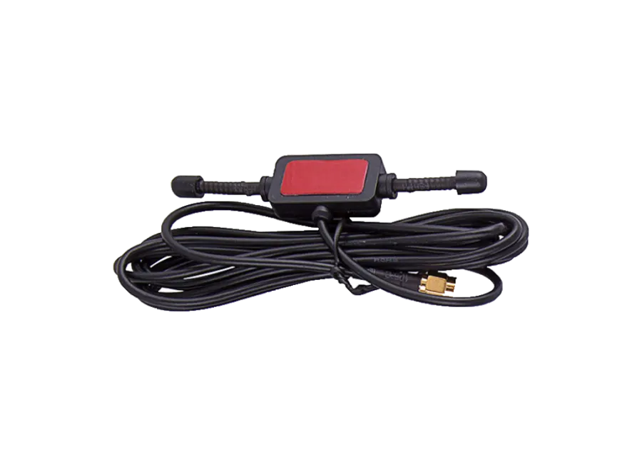
| Internal GSM antenna | yes |
| Internal GPS antenna | yes |
| GSM LED | yes |
| GPS LED | yes |
| Internal GNSS antenna | yes |
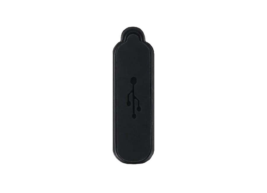
| USB C | yes |
| Communication | |
| GPS | yes |
| GLONASS | yes |
| GALILEO | yes |
| BEIDOU | yes |
| AGPS | yes |
| Sensitivity | -160 dBm |
| GNSS channel number | 96 |
| Accuracy | 2 meter |
| GSM module | SIMCOM 7670 |
| 2G GPRS | yes |
| 2G Operating Region: World | yes |
| 2G Operating Region: Middle East | yes |
| 2G Operating Region: North America | yes |
| 2G Operating region: South America | yes |
| 2G Operating region: Europe | yes |
| 2G Operating region: Asia | yes |
| 2G Operating region: Africa | yes |
| 2G Operating Region: Australia | yes |
| 4G network | yes |
| GPS module name | UNICORE UC6228CI |
| 4G Operating region: Europe | yes |
| 4G Operating region: Asia | yes |
| 4G Operating region: Africa | yes |
| 4G lte | yes |
| FDD 4G Band 1 | yes |
| FDD 4G Band 3 | yes |
| FDD 4G Band 5 | yes |
| FDD 4G Band 8 | yes |
| SMS | yes |
| GSM 900 | yes |
| GSM 1800 | yes |
| SIM card nano | yes |
| Sensor | |
| Accelerometer | yes |
| Speed sensor | yes |
| Accessory | |
| Charging cable | yes |
| BIT | yes |
| Screws | yes |
| Suspension clamp with screw | yes |
| Alarm | |
| Quick speed alarm | yes |
| Digital fence entry alarm | yes |
| Digital fence exit alarm | yes |
| Low battery alarm | yes |
| Displacement alarm | yes |
| Data storage | |
| Internal memory | 4 Megabyte |
| Certificate | |
| CE/RED | yes |
| RoHS | yes |
| Built-in function | |
| Measuring the number of GPS satellites | yes |
| GSM signal strength measurement | yes |
| Setting option | |
| Via SMS | yes |
| Via Internet | yes |
Tracking Software Application
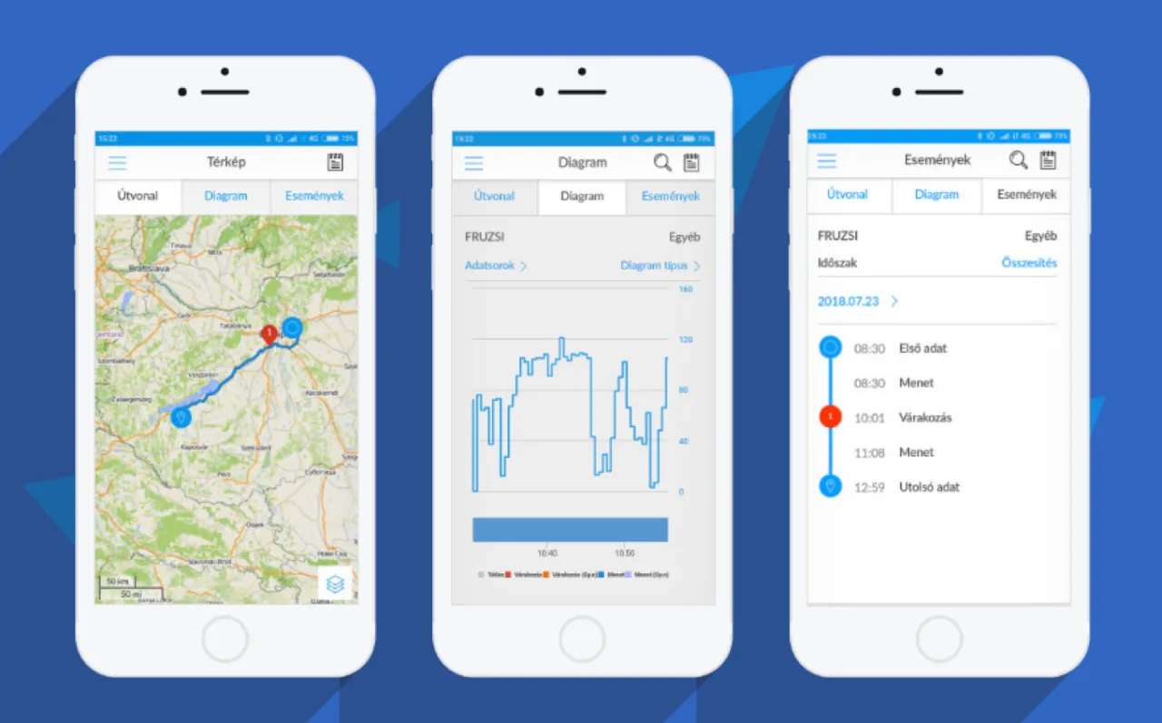
Flexcom tracking software provides professional services that allow you to determine at any moment where the monitored asset (vehicle, machine, cargo, or valuable equipment) is located, where it is heading, and what route it has taken. All of this can be tracked on an interactive map, and related status reports can be displayed and queried in text format – even retroactively for any specified period. In addition to basic functions, POI points can be added and alerts can be set.
The software works with various types of tracking devices, from fixed onboard units to mobile, installation-free models. No special IT skills or software installation are required to operate the devices and use the map service – any modern computer, tablet, or smartphone with an internet connection is sufficient.
Key Features
Do you want to achieve truly high-level GPS tracking?
-
Map Display
You can track your devices on various types of zoomable maps and check their status and surroundings.
-
Real-time Tracking
You can continuously monitor the movement of your fleet and receive real-time information about their current position.
-
Route Playback
Review previously traveled routes of vehicles: road segments, stop points, and related data. You can also create graphical analyses for them.
-
Device Information
Up-to-date information on the status of devices and operating parameters of vehicles (e.g., ignition, speed).
-
Alerts
You can receive immediate notifications via email or SMS about events related to the device or vehicle – for example, movement, leaving a POI zone, towing, ignition, low battery, SOS signal, etc.
-
POIs
Add points and areas important to you on the map. You can set alerts for them or display data in reports (e.g., trip log) in the system.
Demo Videos
- Customer Management
System Access

- Map Usage
Map Types and Functions
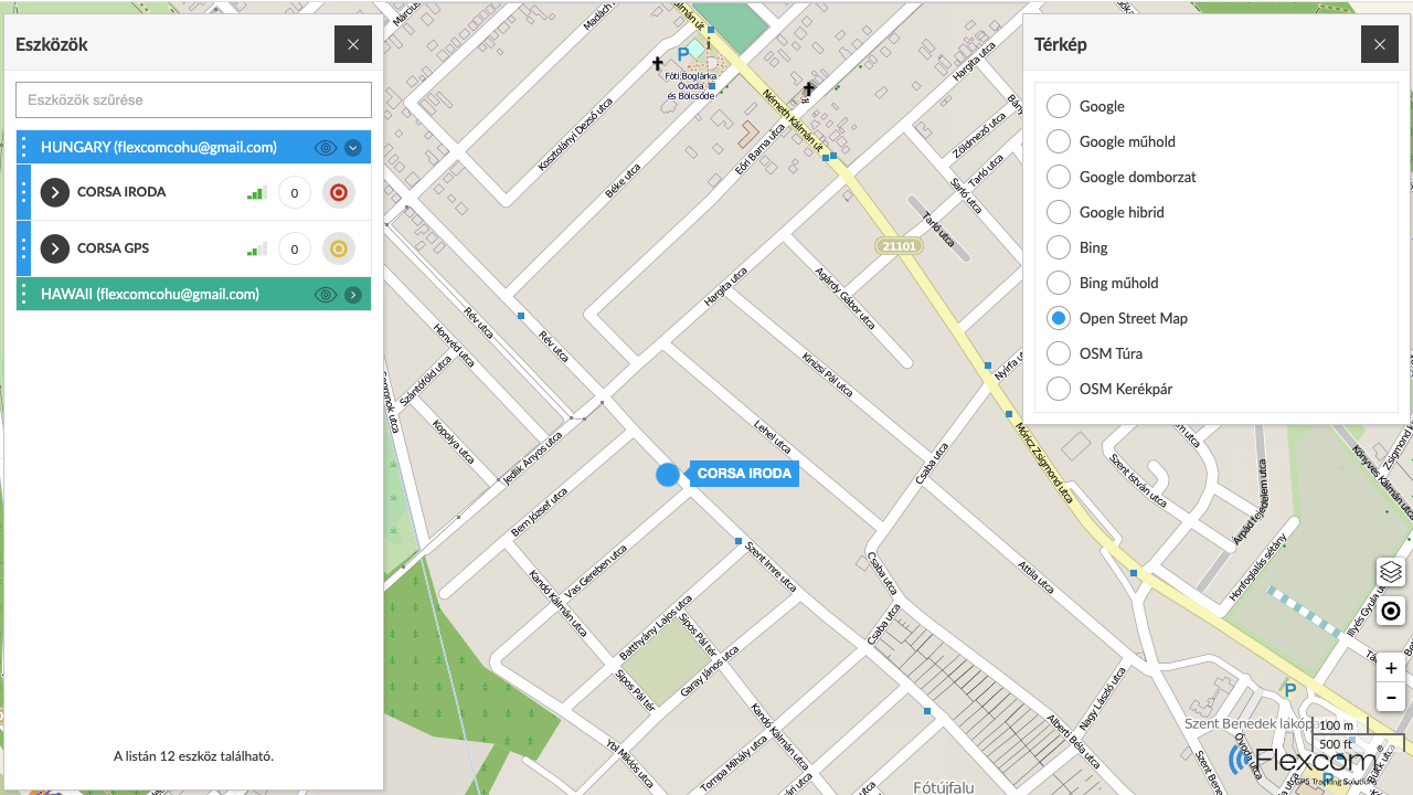
The map is a core element, serving as the "background" of the system. During tracking, several map types can be used, such as versions specialized for road networks, hiking, or cycling paths in the case of Open Street Map.
- Device Management and Tracking
Retrieving Device Information
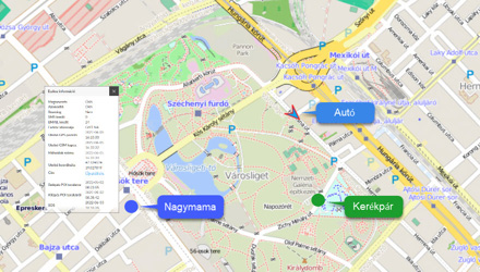
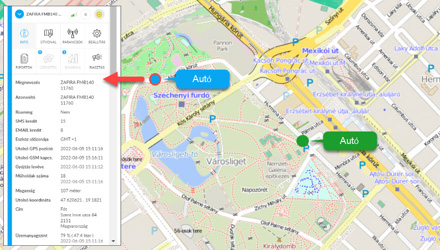
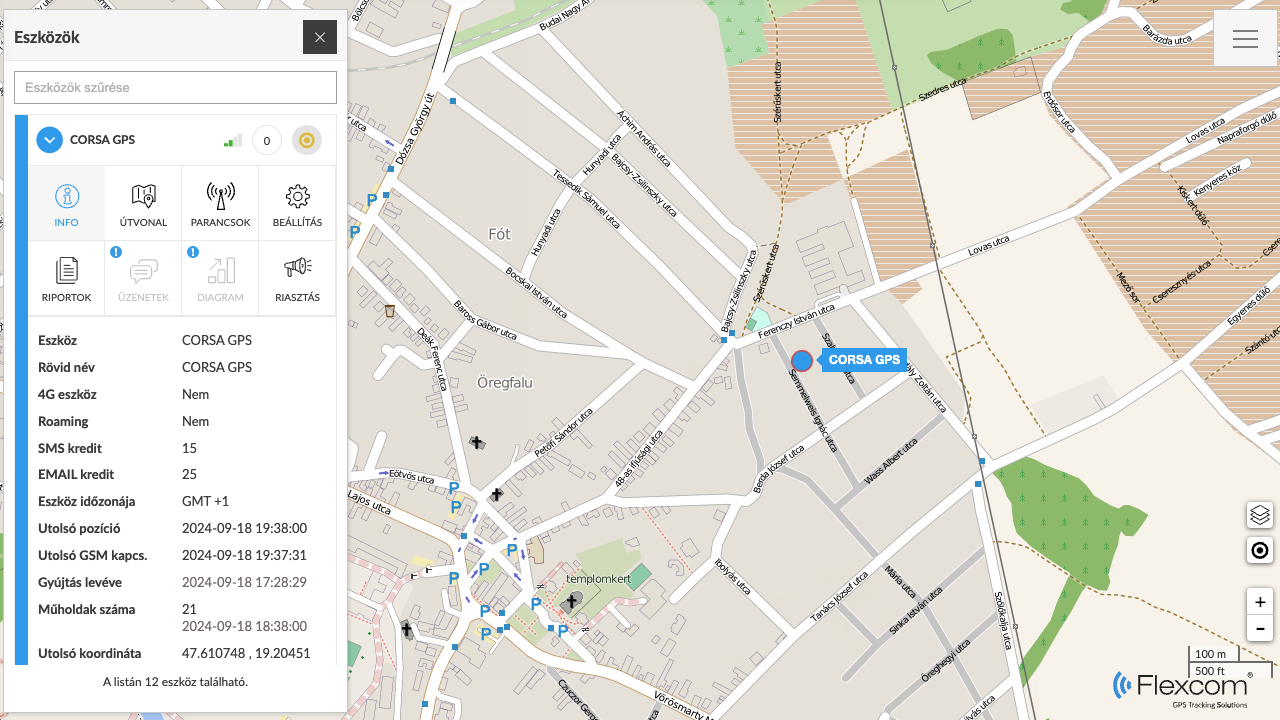
After successful login, the system displays our devices on the map. In addition to real-time tracking of their movements, selecting any device will provide detailed information:
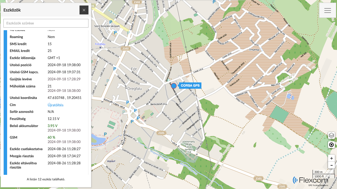
- About the device's position (coordinates and address)
- About the device and network characteristics (e.g., battery level, GSM, and satellite connections)
- About the physical (e.g., fuel, battery, odometer) or health conditions (e.g., blood pressure, pulse, body temperature) of the vehicle or person carrying the device.
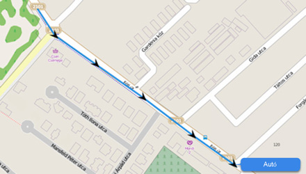
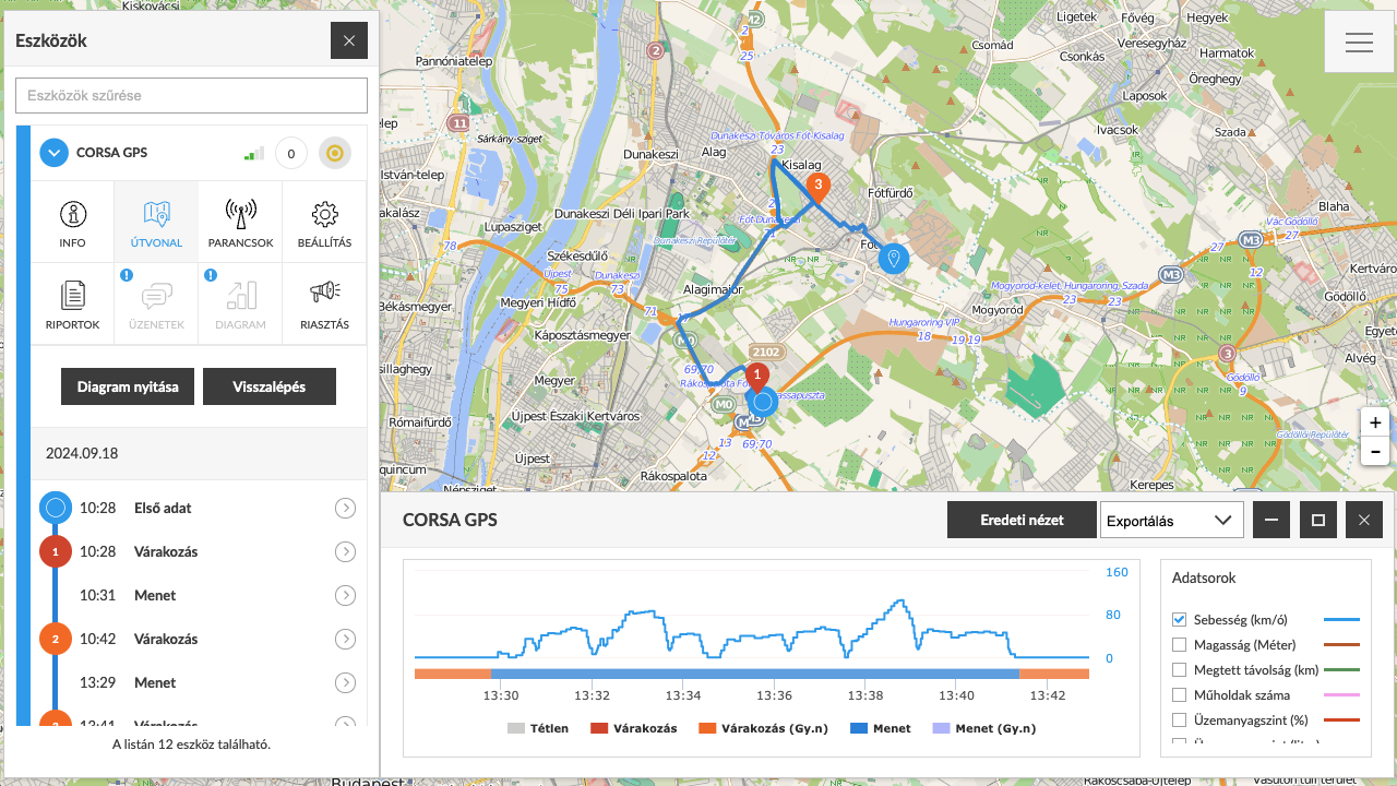
 Displaying Route
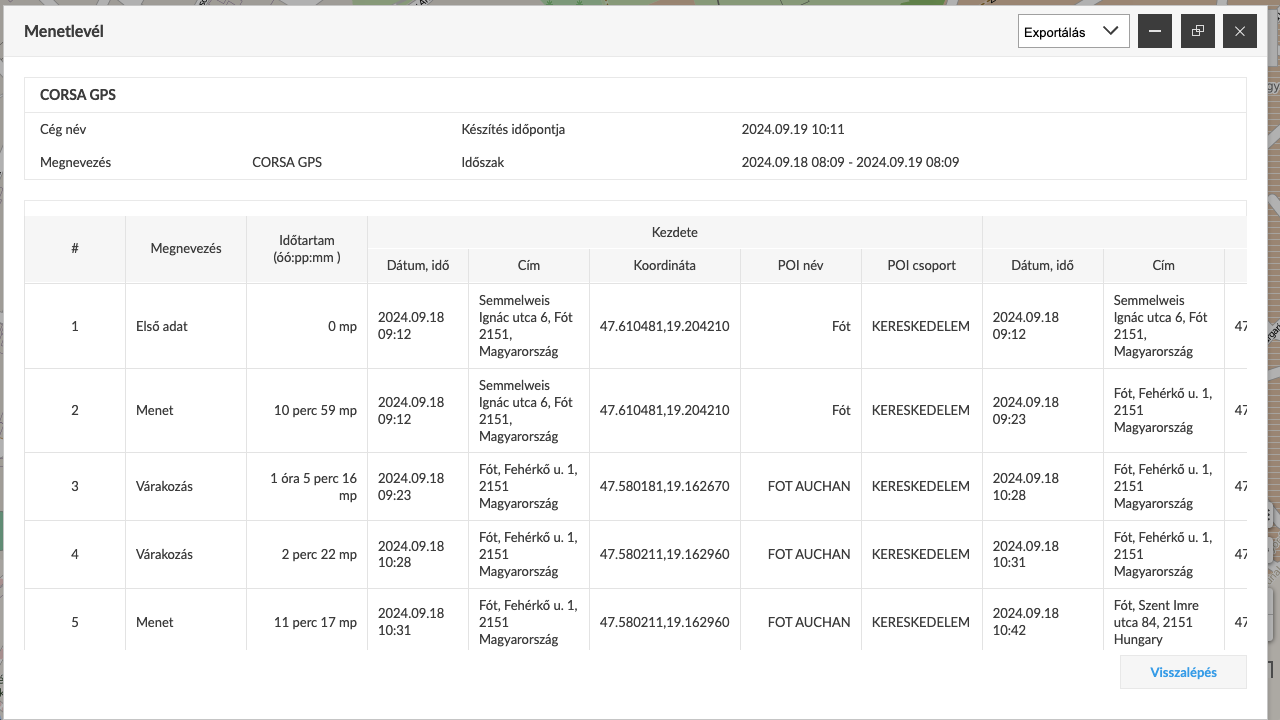
With the tracking system, not only can we see current events, but past events related to the devices and their carriers can also be reconstructed. The route of a selected device for a specified period can be retrieved. The system displays the route and related event points on the map and provides detailed information: how long it took to travel each segment, the speed, distance covered, waiting points, and the duration of stops.
 Device Settings
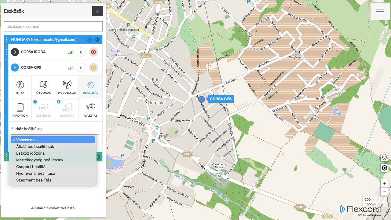
We can set how the central system manages our devices and the incoming data. Devices can be grouped, labeled, and color-coded on the map. The system can be configured with measurement units (e.g., kilometers or miles), how it detects device movements, and which time zone to use.
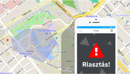
 Alerts
The system can send notifications (alerts) regarding certain events detected by or involving the tracking devices. Alerts can be set up for each device. For smartwatches, a special alert function is the SOS call and message, which the devices execute by calling preset phone numbers and sending emails and/or SMS messages.
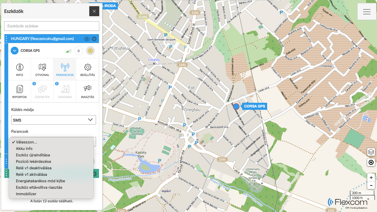
 Commands
The entire system consists of the tracking devices and the tracking software. As technical equipment, the devices have their own operations, such as determining position frequency, contact numbers, alarm clock, or time zone settings, issuing sound signals to locate, remote shutdown, etc. These settings and actions can be executed through the software's Command Sending feature.
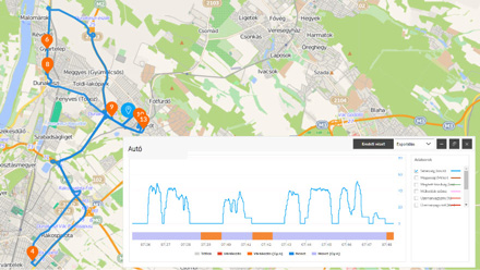
 Reports
Besides the graphical map-based and directly related textual data, complex reports can be created using the Reports feature. A frequently used report, for example, when tracking vehicles, is the trip log.
- Managing POIs
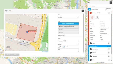
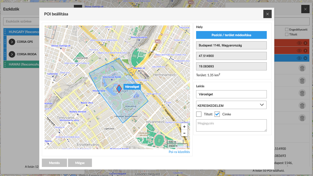
Adding POIs
POIs (Points of Interest) are places of significance that we want to mark on the map. A POI can be a point (e.g., a gas station or store) or an area (e.g., a plot of land or field). Accordingly, point-based and area-based POIs can be added to the tracking system, and the extent of the latter can be drawn. Alerts (notifications) can be linked to the POIs for when a tracking device reaches or leaves them.
- Managing Events
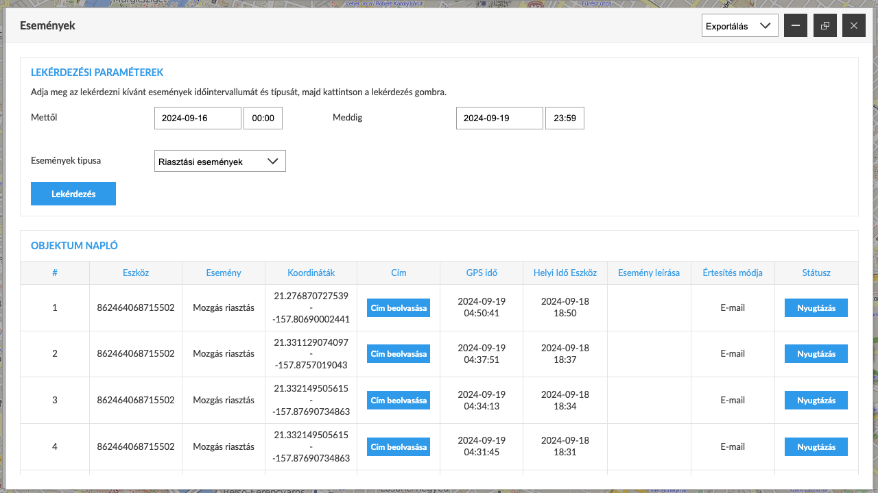
Events and Their Registration. Using the Event Log.
Events are continuously occurring in the tracking system. Devices detect movement, stops, and physical impacts. The processing system analyzes the incoming data and determines related events, which are logged in the event log. The log can be viewed by clients and filtered or queried based on various criteria.
Similar products
Related products
Customer reviews
Product reviews
| 5 Stars | (0) | |
| 4 Stars | (0) | |
| 3 Stars | (0) | |
| 2 Stars | (0) | |
| 1 Stars | (0) |
Last viewed products


Documents
-
 Privacy statement on tracking
English - 1
Privacy statement on tracking
English - 1 -
Payment data transmission
English - 1
-
General Terms and Conditions for the use of GPS positioning services (GPS)
English - 1
-
Simplepay Online Payment System
English - 1
-
 FLEXCOM FB222 CE RED tanúsítvány és megfelelőségi nyilatkozat
Hungarian - 1
FLEXCOM FB222 CE RED tanúsítvány és megfelelőségi nyilatkozat
Hungarian - 1 -
FLEXCOM FB222 ROHS tanúsítvány
Hungarian - 1
-
Payment fizetési tájékoztató
Hungarian - 1
-
Általános Szerződési Feltételek (GPS)
Hungarian - 1
-
Nyomkövetésre vonatkozó adatkezelési nyilatkozat
Hungarian - 1
-
FLEXCOM FB222 IP65 tanúsítvány
Hungarian - 1
Price Alert